


Though online apps (Bikely and Google Maps) do give me a general view of the paths I’ve been tracing over the years, I wanted a more complete picture. I had been treating the paths too piecemeal, needed to map them out to see the whole tracing. Took the Quebec road atlas that I had used to plan my bike trips, and photocopied a slew of pages. It was a pain to piece them together as the legend was different on certain pages — the Gaspésie tip is not quite to scale with the rest of the map. Also, it was hard to be precise as some pages did not align properly despite my efforts. Nonetheless, it was a satisfying exercise sitting on the floor cutting and taping together this growing map, page by page. To my surprise, I was left with a ten-foot long scroll of paper. Had to affix it to the living room wall to be able to see it in its entirety.

I crafted some ad hoc tongue-labels to mark out the waypoints and highlighted the paths. Stepping back I was a little shocked to see that I had traveled all that distance. The map was a visual manifestation of my moving through space, but also the time spent reaching each waypoint. It sounds silly to say, but I find it amazing how the human brain can look at a squiggly line on a map, and this abstract symbol can trigger memories, sensations and inner pictures about having been in that space — in the flesh. That tension between the conceptual and the physical.
The paths themselves were intriguing as well. Their varied shapes were of course dependent on the terrain, but they were also testament to my lack of experience in the beginning of the project. LE-3 starts from Ste-Agathe des Monts and is not attached to the network as I had received a ride up to the Laurentians and rented a bike from the campground. I had not yet attempted long solo cycling trips. Also, A-9 is full of loops and backtracking as I was lost for most of the day, not properly focusing because I was cycling with a friend.

I’ve been making vector paths according to the topographical maps, but the precision makes it very time consuming. Went low tech: took a photograph of the wall and isolated the path in Photoshop. I wanted a quick overview of the pathmap.
In the beginning, the paths did not touch, but over the years, they did create a network — a tracing that largely follows the St-Laurent and the Outaouais river. I was pleased with how the crisscrossing lines looked like discarded thread. The tracing was random in the sense that I was cycling to the bodies of water with one of my family names that were nearest to me, by whatever path which facilitated my travels, further complicated by my admittedly inconsistent orientating skills.
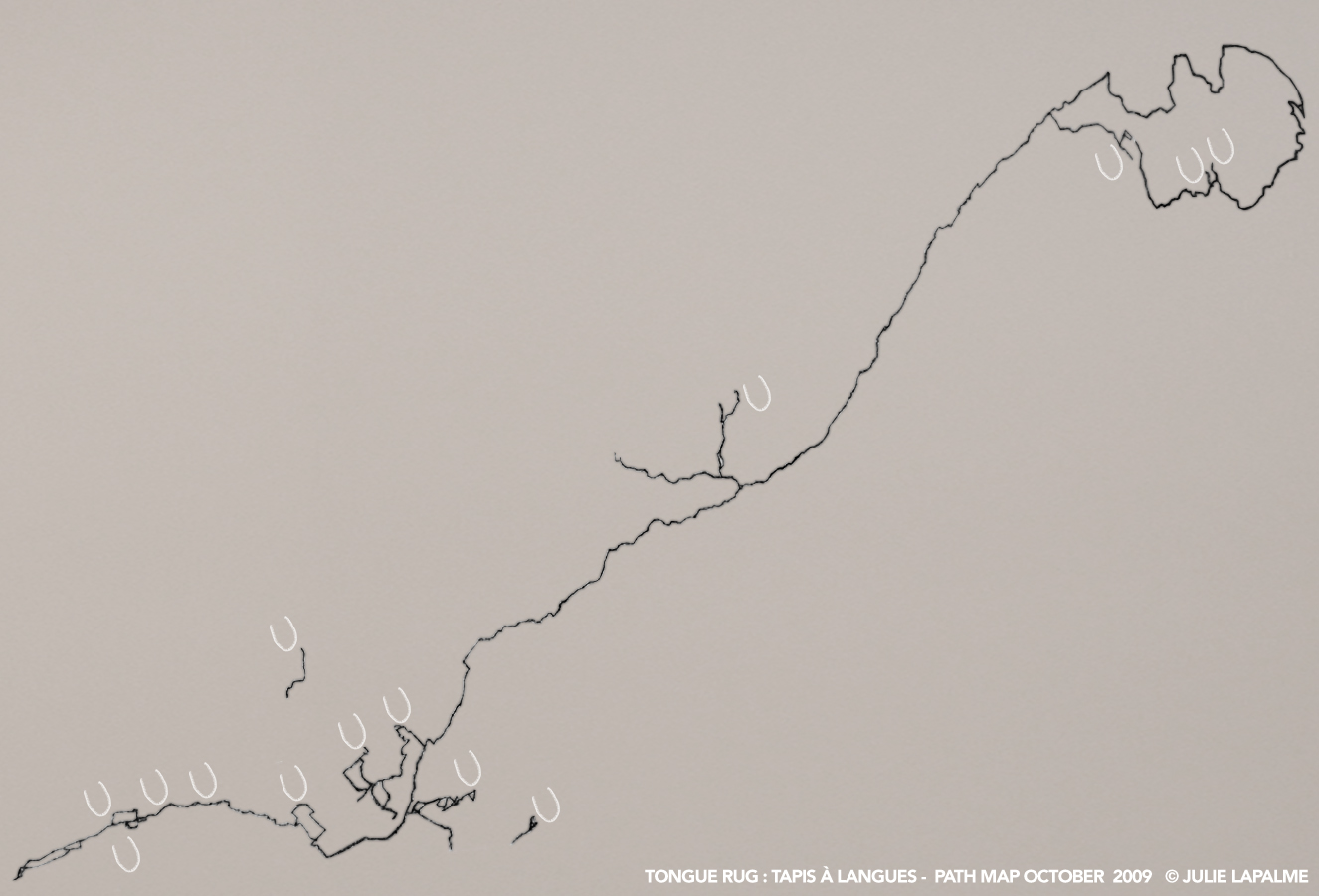
Put some tongue markings as well — a little breast-like but no matter — to get a sense of the tongue rug progress. I don’t get a sense of the sladdakavring yet, as the waypoints are too spread out. I will experiment with other renderings.

No comments:
Post a Comment